Preckwinkle Announces Cook County's New Mapping System

Cook County Board President Toni Preckwinkle today announced that Cook County is upgrading its mapping system to better improve efficiency and services to residents and facilitate graphic representations of what would otherwise be available only as statistical data.
Previously, only County employees who were experts in Geographic Information Systems (GIS) could create interactive, online map applications. Now any employee who knows how to use a simple spreadsheet that includes addresses can create an interactive web mapping app with ArcGIS Online (AGO).
Since Preckwinkle took office, she has prioritized sharing government data with the public. In 2014, Preckwinkle eliminated charges for Cook County's GIS data, making it free and more accessible to the public.
“The public has already paid for the data once with their tax dollars,” President Preckwinkle said. “Making it accessible for everyone to download and use creates positive value for everyone in Cook County.”
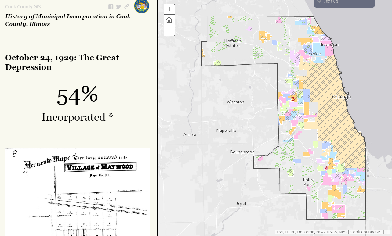
One of the first web maps to come out of Cook County AGO is the "History of Municipal Incorporation in Cook County" which can be found here. This educational “story map” presents a written history along with historical images and documents on the left side of the screen. On the right side of the screen, as you scroll through the text, the map moves forward in time, showing each municipality's incorporation and boundary changes over time.
Another new AGO map, which helps the County operate more efficiently, is the Early Voting Sites map created by the County Clerk's office. The Clerk's office uses the map to route volunteers to the early voting site closest to them that is most in need of their help. The application keeps track of language skills and other special information per early voting site, which helps the Clerk's office send volunteers where they are needed most.
ArcGIS Online can take excel spreadsheets, data published using Environmental Systems Research Institute (ESRI) desktop app and data created within ArcGIS Online to create a collaborative, simple-to-use, web-based app.
The phased implementation of AGO to Cook County agencies is under way. The first agencies to come on line are the County Clerk’s Elections Department, the Emergency Telephone System Board (ETSB) and the Department of Transportation and Highways (DOTH).
County employees and the public will still have access to existing web mapping applications; however, now County employees will have the ability to create their own custom web apps to analyze data, streamline workflows or share information with the public.
